Manual mapping
Resource mapping is done by hand, building by building – slow, expensive, and inconsistent.
AI-powered resource mapping from LiDAR — reuse-focused 3D models and inventories for faster transformation decisions.
The transformation and reuse of existing buildings is held back by the lack of reliable data.
Resource mapping is done by hand, building by building – slow, expensive, and inconsistent.
Drawings are outdated, BIM models don’t exist, and point clouds stay locked in specialist tools.
Circularity, reuse, and taxonomy requirements demand better documentation than current methods can deliver.
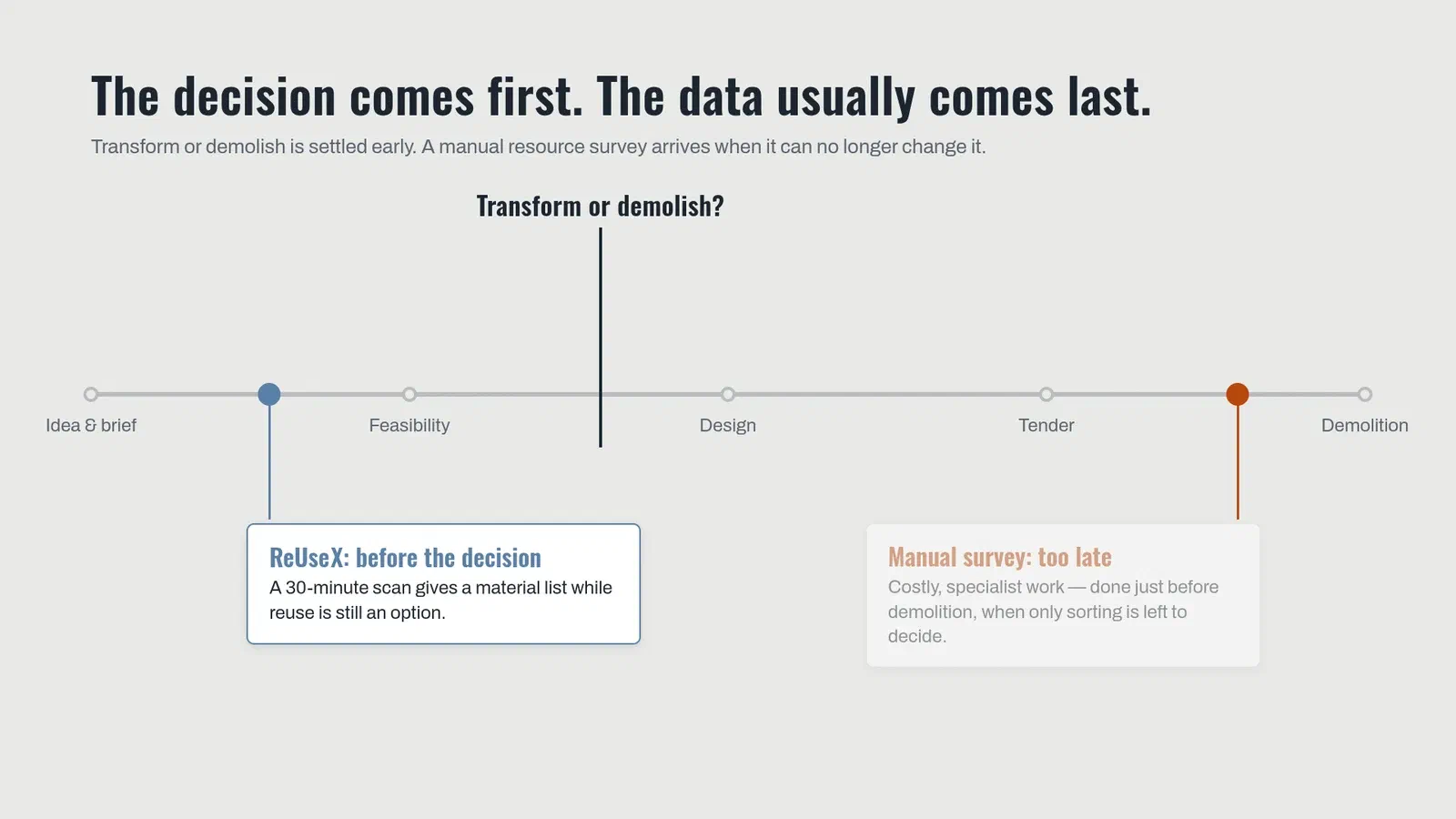
AI-powered resource mapping from LiDAR → circularity-ready 3D models and inventories for faster transformation decisions.
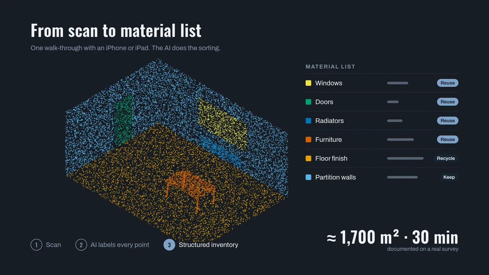
Convert LiDAR scans into simplified, analysis-ready 3D models of existing buildings.
Automatically detect structural elements and building components in the point cloud using AI segmentation.
Generate component inventories and exports that plug into simple 3D, spreadsheets, and analysis workflows.
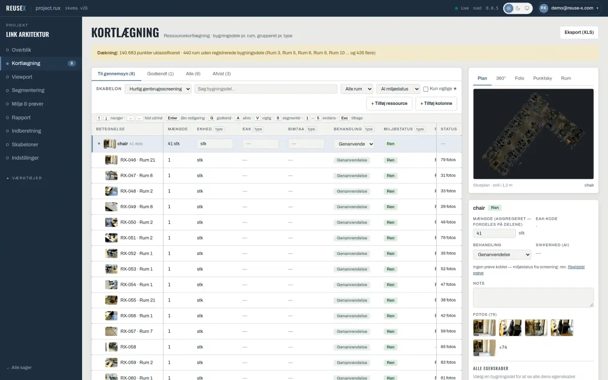
Explore the building in an interactive 3D dashboard. The model, documents, inventories, and analysis results are connected in one place — so municipalities, owners, and consultants work from the same dataset.
Documented: approx. 1,700 m² surveyed and processed into a decision-ready dataset — no special equipment, no expert knowledge required.
1,700m²
surveyed and processed in approx. 30 minutes
852M m²
existing building stock in Denmark — the market
Statistics Denmark, Building Census 2025
41%
of Denmark’s total waste comes from construction
Danish Environmental Protection Agency
0kg
CO₂ counted for reused materials since January 2024
BR18, Social- og Boligstyrelsen


We’re onboarding a limited number of pilot projects with municipalities, building owners and consultants working with existing buildings and adaptive reuse.
Real results from pilot projects already using ReUseX for resource mapping.
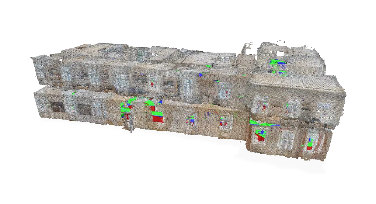
Assess reuse potential before choosing between demolition and transformation. LiDAR scan → AI segmentation → 3D model and reuse inventory to support the feasibility study.
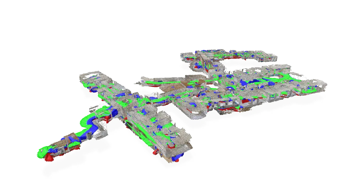
Prioritise which existing buildings to transform or reuse first. Portfolio-level mapping with simplified 3D models and key reuse indicators per building.
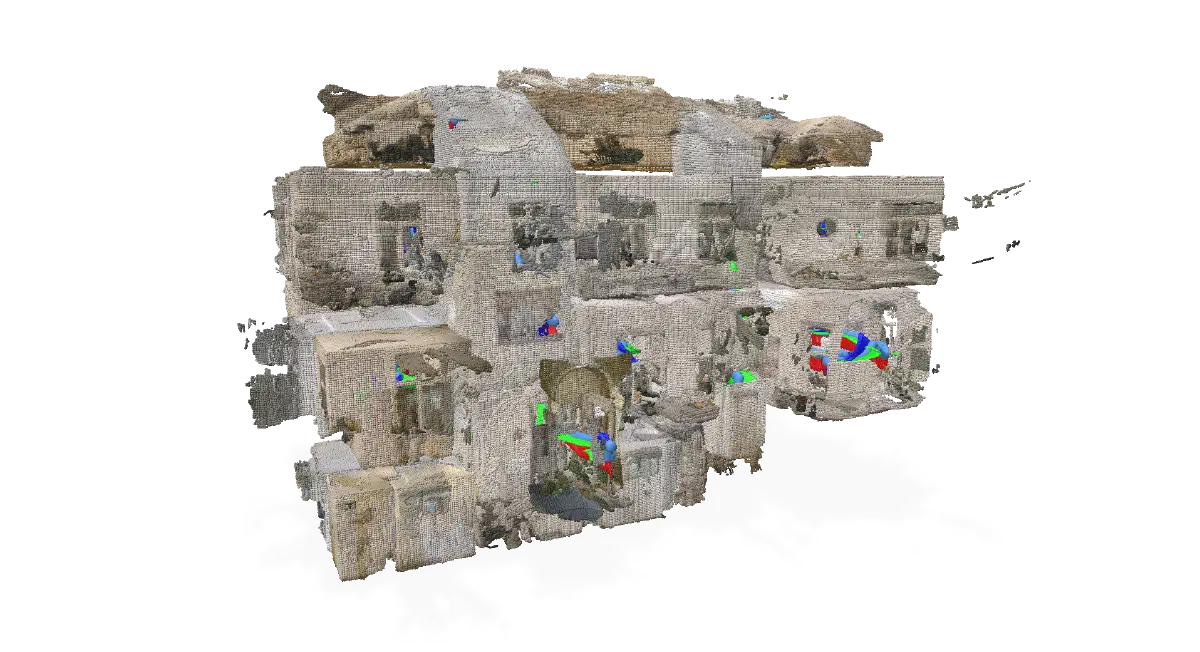
Understand structural reuse options and material potential in an existing school. Detailed component inventory and models used as a basis for design and circularity strategy.


